It’s a crisp autumnal morning in the Duddon Valley, I know the river is stirring beneath the comforting duvet of the early morning mist. Like a petulant teenager it isn’t ready, just yet, to face the day. However, I cannot wait for it, I have things to do and places to go. I gather my tools, a mix of technology, that a teenager might be proud of, and personal safety that gives my mum the comfort to sleep another hour. Her (62¾ year old) baby will be safe.
I have already checked the weather, when I opened the curtains. It’s a beautiful day; the sun is working hard to warm and wake the valley. The sky is clear and dominated by huge swathes of bright, crystal skies. The MetOffice provides a little more grounded reassurance, the day will be calm, dry and warm, for the time of year. There are no unwanted guests expected in this part of the world today. Before I set out, I check my bag, I have our water monitor, my smart phone and of course, a small first aid kit. Now we are off.
The day, or really a couple of hours, becomes a wonderful game of Hopscotch. My route jumps back and forth across the river and leaps along its length. This morning’s route is dictated more by the roads and access than by the river. That said, on my travels I get to dip my toe, or rather water monitor, into varied and sometimes slightly hidden aspects of the river. I will visit its tributaries, and its close neighbours on my travels.
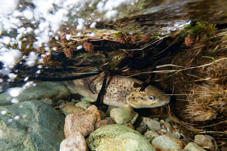
My first stop is in the heart of metropolis, at Thwaites. Here Black Beck turns towards the sea and runs through the village behind the village hall. Taking our fancy water monitor I head for the bridge and drop the sensor down into the water below. Technically, ‘the fancy water monitor’ is a YSI multiparameter portable sonde; you’re pleased you asked, aren’t you? It quickly and easily provides me with a number of measurements which relate to water quality. It also means no one is relying on my ham-fisted grasp of careful testing techniques to gather reliable date. The probe allows me to see the water temperature, the dissolved oxygen, conductivity, pH and nitrates.
As the numbers settle on the screen I turn to my phone. In a testament to our times, I have an app; obviously! The app provides me with a questionnaire which allows me to log all the information I gather. My location is provided by the wonders of the phone’s GPS system, I add a picture and then log the data from our water monitor.
My next stop is in Haverigg, by Milligans. Again, I drop the sensor from the bridge into the water below. I know what to expect. The dissolved oxygen here is generally lower than at many of the sites I will visit. The dissolved oxygen matters as all the aquatic life, the fish and insects of the river need it to survive. Why is it lower here? Well, I can’t really tell you definitively. The lower dissolved oxygen reading, when compared to the higher reaches of the river are not unusual, due to the lack of white water and the heavily modified nature of the river here. Dissolved oxygen can also be affected by the river level; the life of the river using it, breathing; it may be the result of bacteria breaking down organic materials or a combination of factors.
I collect up my kit and skip on to my next site. Now, I have slid from the main road and dropped into the Whitcham valley and you catch up with me at Po House Bridge. I am now into my ritual, water sensor in, allow the numbers to settle and record. The river at Po House is arrow straight, canalised, constrained and told where to go. It rushes by beneath me in its narrow channel, devoid of vegetation the bed scoured clean by the water. Here, I see the nitrate reading rise. The river and its ecosystem need nitrates to prosper. However, as with many things an excess isn’t not good for the river. The excess may cause algae and plants to become too abundant, potentially harming the fish and other life. The numbers here are higher but, I am told, don’t provide a reason for concern.
Onward and another jump, back to Black Beck. We are high up towards the top of Corney Fell. Black Beck. In the summer it’s a place to get lost in the surrounding nature, it’s so easy to become distracted and forget why I am here. Today it’s a little cooler than the valley and less inviting to linger. The Beck is young here, we must be close to the first gatherings of the water on the fell. Its running golden, carrying the colour of the peat from the fell as it chuckles and burbles down towards Thwaites and the sea. The colour and the site are reflected in our pH reading which shows an increased acidity in the water. Excessive acidity in the water puts pressure on species such as Mayflies and Perlidae who have more primitive gills.
Leaving the fell I turn for home and drop down to the Duddon. My next sample point is just below Ulpha Bridge. Its quite here this morning, the river serenely flowing below the bridge, down the valley. In the summer the place is busy with people enjoying the river but they have left their scars, a patchwork of seared and blacken grasses which tell a tale of summer barbeques and boisterous gathering with friend. The sunny setting and lower level reflect in the water temperature reading. The water is a little warmer in the valley but today it has dropped from the highs of the summer. Probably not quite as attractive for our families to swim in but it eases pressure on the river. The lower temperature aids the levels of dissolved oxygen. Allowing the river to maintain its health.
My final stop of the day is a little further downstream on the Duddon, another popular picnic spot in the summer. Although at this time of year the ground is thick with thigh deep, bronze bracken. The river takes a slight tumble here, causing the water to churn white in its haste to head down the valley. The ribbon of water that is Cinderhill Beck joins a little above my sample point and it appear to push the conductivity reading a little higher than at the bridge. The conductivity measures the presence of metals in the water. The more metal that is present the higher the conductivity. I did say the numbers are higher but the truth is that they are generally at the low end of what is to be expected. This should be a good thing, however it does occiasionally make life a little harder. Our e-fishing systems for surveying fish numbers work better if the river has a higher conductivity.
Now my hop-scotch is done and its home time. The river flows on and my samples will add to a developing understanding of the catchment and the water bodies within it. The numbers vary through the seasons and over time I have become used to what I should see. However, the rivers are probably in a better state than many rivers in England. My hope is that as we build the data and keep a watchful eye on the river we can maintain and improve the health of the river. To do that I need to trust others, I have a wonderful round of sampling, taking pictures and enjoying the landscape but I need our experts to add the analysis to allow us all to help maintain this delicate ecosystem.